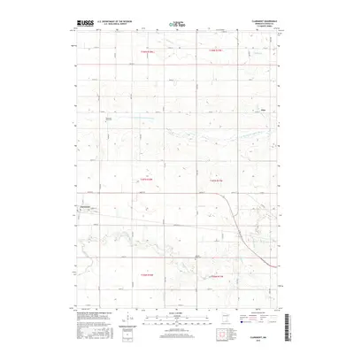
2016 Map of Claremont
USGS Topo · Published 2016About this map
Agricultural lands and rural crossroads characterize this landscape on the border of Dodge and Steele counties. Eden stands as a primary settlement point within the survey, serving as a landmark amidst a grid of section lines and township boundaries. The terrain is defined by its drainage patterns, most notably where the S Br Middle Fork Zumbro River cuts through the northern sections. This waterway, along with its various tributaries, dictates the local topography and historical placement of farmsteads. The transition between T108N R18W and T107N R17W illustrates the methodical Public Land Survey System that organized this region of Minnesota into its distinctive rectilinear pattern of roads and fields.
Find a feature on this map
1 named feature on this map. Tap any name to fly to it.
Don’t see what you’re looking for? This feature index may not catch every label — zoom into the map to look around manually.
Map Details
Editions of this 2016 Claremont Map
This is the sole edition of this map. No revisions or reprints were ever made.
Other maps of this area

1953 · Saint Paul
USGS Topo · 1:250,000

1954 · Mason City
USGS Topo · 1:250,000

1957 · Mason City
USGS Topo · 1:250,000

1958 · Mason City
USGS Topo · 1:250,000

1959 · Saint Paul
USGS Topo · 1:250,000

1962 · Moland
USGS Topo · 1:24,000

1962 · Owatonna SE
USGS Topo · 1:24,000

1965 · Dodge Center
USGS Topo · 1:24,000

1965 · Concord
USGS Topo · 1:24,000

1965 · Claremont
USGS Topo · 1:24,000