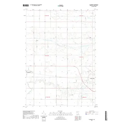
2019 Map of Claremont
USGS Topo · Published 2019About this map
Claremont and the western edge of Dodge Center anchor this agricultural landscape in Dodge County, where the plains are etched by the winding course of the S Br Middle Fork Zumbro River. This survey captures the rural character of the region as it appeared in the late 2010s, defined by a rigid grid of township roads such as 620th St and Co Rd G that negotiate the riparian corridors. Genealogists and local historians can locate established burial grounds including the Claremont Street Cem and the Ashland-Ripley Cem, which serve as quiet landmarks among the expansive fields. Small watercourses like Dodge Center Cr, Milliken Cr, and Henslin Cr dictate the local topography, creating natural breaks in the otherwise uniform section lines of T107N and T108N.
Find a feature on this map
35 named features on this map. Tap any name to fly to it.
Don’t see what you’re looking for? This feature index may not catch every label — zoom into the map to look around manually.
Map Details
Editions of this 2019 Claremont Map
This is the sole edition of this map. No revisions or reprints were ever made.
Other maps of this area

1953 · Saint Paul
USGS Topo · 1:250,000

1954 · Mason City
USGS Topo · 1:250,000

1957 · Mason City
USGS Topo · 1:250,000

1958 · Mason City
USGS Topo · 1:250,000

1959 · Saint Paul
USGS Topo · 1:250,000

1962 · Moland
USGS Topo · 1:24,000

1962 · Owatonna SE
USGS Topo · 1:24,000

1965 · Dodge Center
USGS Topo · 1:24,000

1965 · Concord
USGS Topo · 1:24,000

1965 · Claremont
USGS Topo · 1:24,000