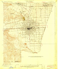
1928 Map of Claremont
USGS Topo · Published 1928About this map
Pomona College anchors the northeastern corner of this 1920s landscape, representing the academic heart of a region quickly transitioning from citrus groves to suburban development. The intersection of major rail lines, including the Southern Pacific, Union Pacific, and the interurban Pacific Electric, highlights Pomona as a vital transportation hub. To the north, the Los Angeles County Fair Grounds and Ganesha Park provide evidence of early 20th-century civic and recreational planning near the foothills of the San Jose Hills.
Find a feature on this map
45 named features on this map. Tap any name to fly to it.
Don’t see what you’re looking for? This feature index may not catch every label — zoom into the map to look around manually.
Map Details
Editions of this 1928 Claremont Map
3 editions found
Other maps of this area

1894 · Pomona
USGS Topo · 1:62,500

1896 · Anaheim
USGS Topo · 1:62,500

1897 · Pomona
USGS Topo · 1:62,500

1897 · Cucamonga
USGS Topo · 1:62,500

1898 · Pomona
USGS Topo · 1:62,500

1898 · Anaheim
USGS Topo · 1:62,500

1900 · Cucamonga
USGS Topo · 1:62,500

1901 · Southern California Sheet No. 1
USGS Topo · 1:250,000

1901 · Anaheim
USGS Topo · 1:62,500

1902 · Corona
USGS Topo · 1:125,000