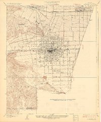
1928 Map of Claremont
USGS Topo · Published 1928About this map
Pomona serves as the dense urban anchor of this late 1920s survey, surrounded by a burgeoning landscape of educational institutions and agricultural commerce. The northern boundary is defined by the academic grounds of Pomona College in Claremont, while the western edge is dominated by the Los Angeles County Fair Grounds and the recreational expanse of the Mountain Meadows Country Club. A complex grid of avenues, including Cucamonga Avenue and Holt Avenue, reflects the rapid transition of the Pomona Valley from open country into a structured citrus-belt community.
Find a feature on this map
40 named features on this map. Tap any name to fly to it.
Don’t see what you’re looking for? This feature index may not catch every label — zoom into the map to look around manually.
Map Details
Editions of this 1928 Claremont Map
3 editions found
Other maps of this area

1894 · Pomona
USGS Topo · 1:62,500

1896 · Anaheim
USGS Topo · 1:62,500

1897 · Pomona
USGS Topo · 1:62,500

1897 · Cucamonga
USGS Topo · 1:62,500

1898 · Pomona
USGS Topo · 1:62,500

1898 · Anaheim
USGS Topo · 1:62,500

1900 · Cucamonga
USGS Topo · 1:62,500

1901 · Southern California Sheet No. 1
USGS Topo · 1:250,000

1901 · Anaheim
USGS Topo · 1:62,500

1902 · Corona
USGS Topo · 1:125,000