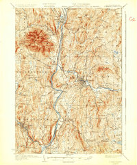
1929 Map of Claremont
USGS Topo · Published 1932About this map
The Connecticut River serves as the central artery for this late 1920s survey, marking the state boundary between Vermont and New Hampshire. Dominating the western skyline is the massive peak of Ascutney Mtn, while the eastern side of the river features the industrial hub of Claremont and the smaller textile and milling hamlets of Cornish Mills and West Claremont. The river's historical importance for transit is evidenced by multiple crossings, including the Cornish Bridge and the Cheshire Toll Bridge, alongside the Ashley Ferry.
Find a feature on this map
135 named features on this map. Tap any name to fly to it.
Don’t see what you’re looking for? This feature index may not catch every label — zoom into the map to look around manually.
Map Details
Editions of this 1929 Claremont Map
4 editions found

Other maps of this area

1902 · Sunapee
USGS Topo · 1:62,500

1905 · Sunapee
USGS Topo · 1:62,500

1906 · Hanover
USGS Topo · 1:62,500

1907 · Sunapee
USGS Topo · 1:62,500

1908 · Hanover
USGS Topo · 1:62,500

1911 · Woodstock
USGS Topo · 1:62,500

1913 · Woodstock
USGS Topo · 1:62,500

1926 · Claremont
USGS Topo · 1:62,500

1927 · Bellows Falls
USGS Topo · 1:48,000

1927 · Mascoma
USGS Topo · 1:62,500