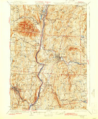
1929 Map of Claremont
USGS Topo · Published 1944About this map
The Connecticut River serves as the central artery for this borderland study, dividing the granite-ribbed terrain of Windsor County, Vermont, from the industrial and agricultural valleys of Sullivan County, New Hampshire. Dominating the western skyline is the massive profile of Ascutney Mtn, while the cultural landscape is marked by the St Gaudens Memorial near Cornish Bridge. The map captures a high density of rural infrastructure, including a network of local district schools like Sheddsville Sch and Brick Sch, alongside the industrial hubs of Claremont and Springfield.
Find a feature on this map
122 named features on this map. Tap any name to fly to it.
Don’t see what you’re looking for? This feature index may not catch every label — zoom into the map to look around manually.
Map Details
Editions of this 1929 Claremont Map
4 editions found

Other maps of this area

1902 · Sunapee
USGS Topo · 1:62,500

1905 · Sunapee
USGS Topo · 1:62,500

1906 · Hanover
USGS Topo · 1:62,500

1907 · Sunapee
USGS Topo · 1:62,500

1908 · Hanover
USGS Topo · 1:62,500

1911 · Woodstock
USGS Topo · 1:62,500

1913 · Woodstock
USGS Topo · 1:62,500

1926 · Claremont
USGS Topo · 1:62,500

1927 · Bellows Falls
USGS Topo · 1:48,000

1927 · Mascoma
USGS Topo · 1:62,500