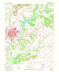
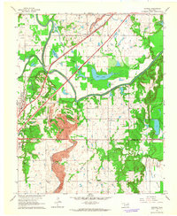
1963 Map of Claremore
USGS Topo · Published 1980About this map
Claremore serves as the focal point of this Rogers County survey, showing a landscape defined by the intersection of major transportation routes and the winding path of Dog Creek. The town's expansion is documented through purple photorevision, highlighting new urban growth and facilities such as the Service Facility Drive-in Theater and Will Rogers Jr High Sch. To the northeast, Lake Claremore and its Fish Hatchery dominate the local geography, while the Will Rogers Turnpike carves a straight line across the countryside, crossing the older tracks of the St Louis-San Francisco and Missouri Pacific railroads. Moving south toward the Verdigris Hills, the land transitions into a more rural character marked by the Lowrance Ranch and the small community of Tiawah, where an Aqueduct and numerous oil wells reflect the region's diverse economic reliance on both water management and petroleum extraction.
Find a feature on this map
32 named features on this map. Tap any name to fly to it.
Don’t see what you’re looking for? This feature index may not catch every label — zoom into the map to look around manually.
Map Details
Editions of this 1963 Claremore Map
3 editions found
Other maps of this area

1896 · Pryor
USGS Topo · 1:125,000

1901 · Claremore
USGS Topo · 1:125,000

1901 · Pryor
USGS Topo · 1:125,000

1914 · Claremore
USGS Topo · 1:125,000

1916 · Claremore
USGS Topo · 1:125,000

1954 · Tulsa
USGS Topo · 1:250,000

1958 · Tulsa
USGS Topo · 1:250,000

1963 · Tulsa
USGS Topo · 1:250,000
1963 · Sageeyah
USGS Topo · 1:24,000
1963 · Catoosa
USGS Topo · 1:24,000