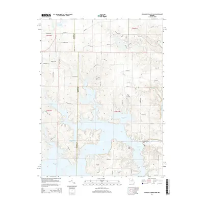
2014 Map of Clarence Cannon Dam
USGS Topo · Published 2014About this map
Mark Twain Lake dominates the central and southern reaches of this landscape, created by the massive engineering of the Clarence Cannon Dam on the Salt River. This 2014 survey documents a region defined by water management and recreation, where the large reservoir fingers into the surrounding hills, creating complex shorelines near The Landing and Cedar Ridge. North of the main lake, smaller bodies of water like Monroe City Lake, Henderson Lake, and Monroe Lake B are interspersed among a network of local roads including Monroe Road 370 and Monroe Road 594.
Find a feature on this map
61 named features on this map. Tap any name to fly to it.
Don’t see what you’re looking for? This feature index may not catch every label — zoom into the map to look around manually.
Map Details
Editions of this 2014 Clarence Cannon Dam Map
This is the sole edition of this map. No revisions or reprints were ever made.
Other maps of this area

1890 · Mexico
USGS Topo · 1:125,000

1903 · Palmyra
USGS Topo · 1:125,000

1945 · Florida
USGS Topo · 1:62,500

1945 · Perry
USGS Topo · 1:62,500

1948 · Quincy
USGS Topo · 1:250,000

1956 · Quincy
USGS Topo · 1:250,000
1958 · Rensselaer
USGS Topo · 1:24,000

1959 · Monroe City
USGS Topo · 1:24,000

1959 · Joanna
USGS Topo · 1:24,000
1959 · Center
USGS Topo · 1:24,000