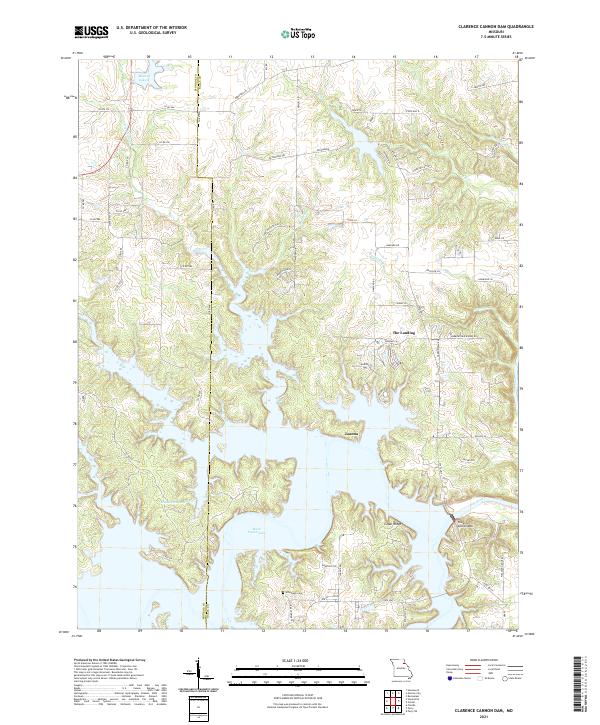
2021 Map of Clarence Cannon Dam
USGS Topo · Published 2021About this map
Clarence Cannon Dam anchors this landscape in eastern Missouri, where it impounds the Salt River to form the expansive waters of Mark Twain Lake. The modern topography reflects a massive alteration of the river valley, with flooded fingers of the lake reaching into drainages like Rocklick Br and Madden Br. While newer recreational areas and residential clusters like The Landing and Cedar Ridge overlook the water, older markers of the land's history remain. The Utterback Cem sits on a ridge near the rural settlement of Joanna, providing a vital link for genealogists tracing families in the Monroe and Ralls County borderlands. Smaller water bodies like Henderson Lake and Monroe Lake B are interspersed among a network of county roads and local lanes such as Hereford Ln and Bethlehem Trl.
Find a feature on this map
68 named features on this map. Tap any name to fly to it.
Don’t see what you’re looking for? This feature index may not catch every label — zoom into the map to look around manually.
Map Details
Editions of this 2021 Clarence Cannon Dam Map
This is the sole edition of this map. No revisions or reprints were ever made.
Other maps of this area

1890 · Mexico
USGS Topo · 1:125,000

1903 · Palmyra
USGS Topo · 1:125,000

1945 · Florida
USGS Topo · 1:62,500

1945 · Perry
USGS Topo · 1:62,500

1948 · Quincy
USGS Topo · 1:250,000

1956 · Quincy
USGS Topo · 1:250,000
1958 · Rensselaer
USGS Topo · 1:24,000

1959 · Monroe City
USGS Topo · 1:24,000

1959 · Joanna
USGS Topo · 1:24,000
1959 · Center
USGS Topo · 1:24,000