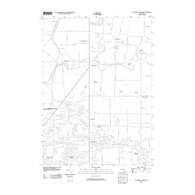
2010 Map of Clarence Center
USGS Topo · Published 2010About this map
The Erie Canal cuts through the northwestern corner of this landscape, a enduring piece of transit infrastructure that predates the modern residential expansion seen elsewhere on the sheet. The area is defined by a series of small, established hamlets including Clarence Center, Swormville, and Millersport, which serve as anchors for the surrounding rural and suburbanizing landscape. Aviation history is notably dense here, with three distinct landing facilities: the North Buffalo Suburban Airport, the Clarence Aerodrome, and Potoczak Airport. Waterways such as Tonawanda Creek and Ransom Creek meander through the terrain, influencing the layout of local roads and the placement of long-standing community sites like Saint Marys Cemetery and Saint Pauls Cemetery. The map also captures specialized agricultural operations such as Badding Brothers Farm and Szulis Greenhouse, reflecting the persistent role of local production amidst growing residential developments like Woodstream Farms.
Find a feature on this map
75 named features on this map. Tap any name to fly to it.
Don’t see what you’re looking for? This feature index may not catch every label — zoom into the map to look around manually.
Map Details
Editions of this 2010 Clarence Center Map
This is the sole edition of this map. No revisions or reprints were ever made.
Other maps of this area

1894 · Buffalo
USGS Topo · 1:62,500

1897 · Tonawanda
USGS Topo · 1:62,500

1897 · Lockport
USGS Topo · 1:62,500

1899 · Niagara
USGS Topo · 1:125,000

1900 · Tonawanda
USGS Topo · 1:62,500

1901 · Buffalo
USGS Topo · 1:62,500

1901 · Tonawanda
USGS Topo · 1:62,500

1902 · Lockport
USGS Topo · 1:62,500

1905 · Depew
USGS Topo · 1:62,500

1905 · Lockport
USGS Topo · 1:62,500