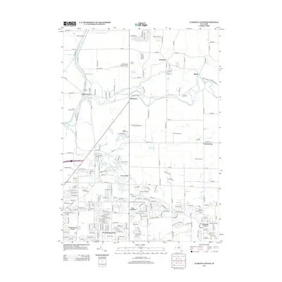
2013 Map of Clarence Center
USGS Topo · Published 2013About this map
Clarence Center and Swormville anchor this 2013 survey of northeastern Erie County, where suburban expansion meets legacy agricultural lands. The landscape is defined by the winding course of Tonawanda Cr, which separates Pendleton from the township to the south. Historically significant hubs like Millersport and Wolcottsburg sit near the many smaller waterways that drain the region, including Ransom Cr and Black Cr. Local heritage is preserved in numerous consecrated grounds such as Saint Marys Cem and Queen of Heaven Cem, while the area's aviation history is represented by the Clarence Aerodrome and Potoczak Airport. Commercial and recreational landmarks like the Transit Drive-In and Badding Brothers Farm highlight the cultural character of these communities as they grew in the early twenty-first century.
Find a feature on this map
57 named features on this map. Tap any name to fly to it.
Don’t see what you’re looking for? This feature index may not catch every label — zoom into the map to look around manually.
Map Details
Editions of this 2013 Clarence Center Map
This is the sole edition of this map. No revisions or reprints were ever made.
Other maps of this area

1894 · Buffalo
USGS Topo · 1:62,500

1897 · Tonawanda
USGS Topo · 1:62,500

1897 · Lockport
USGS Topo · 1:62,500

1899 · Niagara
USGS Topo · 1:125,000

1900 · Tonawanda
USGS Topo · 1:62,500

1901 · Buffalo
USGS Topo · 1:62,500

1901 · Tonawanda
USGS Topo · 1:62,500

1902 · Lockport
USGS Topo · 1:62,500

1905 · Depew
USGS Topo · 1:62,500

1905 · Lockport
USGS Topo · 1:62,500