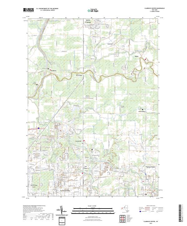
2023 Map of Clarence Center
USGS Topo · Published 2023About this map
Tonawanda Creek snakes across this landscape, defining the boundary between Niagara Co and Erie Co. This modern topographic study reveals a suburban interface where established settlements like Clarence Center and Pendleton are interconnected by a dense network of roads such as Mapleton Rd and Donner Rd. The presence of several localized aviation sites, including the Clarence Aerodrome and Potoczak Airport, highlights the area's development beyond its traditional agrarian roots.
Find a feature on this map
191 named features on this map. Tap any name to fly to it.
Don’t see what you’re looking for? This feature index may not catch every label — zoom into the map to look around manually.
Map Details
Editions of this 2023 Clarence Center Map
This is the sole edition of this map. No revisions or reprints were ever made.
Other maps of this area

1894 · Buffalo
USGS Topo · 1:62,500

1897 · Tonawanda
USGS Topo · 1:62,500

1897 · Lockport
USGS Topo · 1:62,500

1899 · Niagara
USGS Topo · 1:125,000

1900 · Tonawanda
USGS Topo · 1:62,500

1901 · Buffalo
USGS Topo · 1:62,500

1901 · Tonawanda
USGS Topo · 1:62,500

1902 · Lockport
USGS Topo · 1:62,500

1905 · Depew
USGS Topo · 1:62,500

1905 · Lockport
USGS Topo · 1:62,500