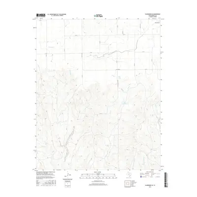
2016 Map of Clarendon SE
USGS Topo · Published 2016About this map
Windy Valley sits at the northern edge of this landscape in Donley County, where the Texas Panhandle terrain begins to break into the complex drainage systems of the Red River watershed. This territory is defined by the headwaters of numerous creeks, including the westward reaches of E Lelia Lake Cr and the deeply incised valleys of West Bitter Creek. The distribution of water sources like West Spring, East Spring, and Bitter Creek Spring highlights the critical importance of reliable water in this ranching country. A network of rural roads, such as Ranch Rd 1260 and Bitter Creek Ranch Rd, provides access to interior landmarks like Bitter Creek Ranch Lake. The naming conventions of features like Little John Mann Cr and Big John Mann Cr reflect the local history and family lineages tied to these specific drainages.
Find a feature on this map
32 named features on this map. Tap any name to fly to it.
Don’t see what you’re looking for? This feature index may not catch every label — zoom into the map to look around manually.
Map Details
Editions of this 2016 Clarendon SE Map
This is the sole edition of this map. No revisions or reprints were ever made.
Other maps of this area

1954 · Plainview
USGS Topo · 1:250,000

1958 · Plainview
USGS Topo · 1:250,000

1959 · Lelia Lake Creek
USGS Topo · 1:24,000

1960 · Brice
USGS Topo · 1:62,500

1961 · Memphis
USGS Topo · 1:62,500

1962 · Lelia Lake
USGS Topo · 1:24,000

1963 · Hedley
USGS Topo · 1:24,000

1963 · Clarendon
USGS Topo · 1:24,000

1963 · Clarendon SE
USGS Topo · 1:24,000

1963 · Clarendon SW
USGS Topo · 1:24,000