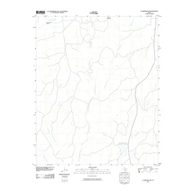
2010 Map of Clarendon SW
USGS Topo · Published 2010About this map
Gunboat Mountain rises above a landscape defined by an intricate network of waterways in this portion of Donley County. The terrain is deeply etched by numerous drainages, most notably Troublesome Canyon and its namesake Troublesome Creek in the north. The area demonstrates the region's reliance on water management and land conservation, evidenced by the Soil Conservation Service Site 1 Reservoir situated near the headwaters of Brushy Creek. This 2010 survey illustrates a primarily rural ranching or agricultural environment, where the natural topography dictates the path of local routes like Co RD 7 and Co RD X. The confluence of various streams, including Big Sandy Creek, Betty Creek, and Cottonwood Creek, underscores the complex natural drainage patterns characteristic of the Texas Panhandle's rolling plains.
Find a feature on this map
12 named features on this map. Tap any name to fly to it.
Don’t see what you’re looking for? This feature index may not catch every label — zoom into the map to look around manually.
Map Details
Editions of this 2010 Clarendon SW Map
This is the sole edition of this map. No revisions or reprints were ever made.
Other maps of this area

1954 · Plainview
USGS Topo · 1:250,000

1958 · Plainview
USGS Topo · 1:250,000

1960 · Indian Peak
USGS Topo · 1:62,500

1960 · Brice
USGS Topo · 1:62,500

1962 · Lelia Lake
USGS Topo · 1:24,000

1963 · Clarendon
USGS Topo · 1:24,000

1963 · Buffalo Arroyo
USGS Topo · 1:24,000

1963 · Clarendon SE
USGS Topo · 1:24,000

1963 · Tate Arroyo
USGS Topo · 1:24,000

1963 · Clarendon SW
USGS Topo · 1:24,000