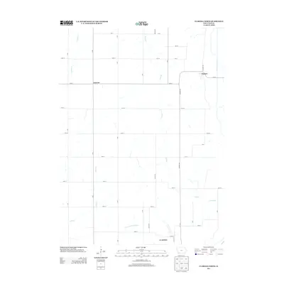
2013 Map of Clarinda North
USGS Topo · Published 2013About this map
Clarinda sits at the southern edge of this West-Central Iowa landscape, where the town's northern expansion meets the fertile bottomlands of the N Br W Nodaway River. The map shows a strictly gridded agricultural territory defined by a network of alphanumeric roads, including Quince Ave and Redwood Ave. Small rural centers provide focal points for the surrounding farmstead economy, notably the crossroads at Bethesda and the settlement of Hepburn near the eastern margin. Waterways like Neele Br and E Tarkio Cr slice through the rectangular sections, showing the natural drainage patterns that dictate the placement of fields and woodlots. This survey provides a clear view of Page County's land use in the early 21st century, where industrial-scale farming and the steady growth of the county seat coexist with small, established rural communities.
Find a feature on this map
35 named features on this map. Tap any name to fly to it.
Don’t see what you’re looking for? This feature index may not catch every label — zoom into the map to look around manually.
Map Details
Editions of this 2013 Clarinda North Map
This is the sole edition of this map. No revisions or reprints were ever made.
Other maps of this area

1940 · Coin
USGS Topo · 1:62,500

1940 · New Market
USGS Topo · 1:62,500

1943 · Coin
USGS Topo · 1:62,500

1943 · New Market
USGS Topo · 1:62,500

1955 · Nebraska City
USGS Topo · 1:250,000

1957 · Nebraska City
USGS Topo · 1:250,000

1958 · Nebraska City
USGS Topo · 1:250,000

1978 · Stanton
USGS Topo · 1:24,000

1978 · Stanton SW
USGS Topo · 1:24,000

1978 · Clarinda North
USGS Topo · 1:24,000