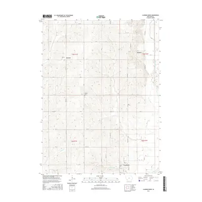
2015 Map of Clarinda North
USGS Topo · Published 2015About this map
Clarinda anchors the southern edge of this Iowa landscape, where the northern residential and institutional reaches of the town give way to the agricultural expanse of Page County. This 2015 survey illustrates a land strictly organized by the Public Land Survey System, with a dense grid of gravel and paved roads like Co Hwy M63 and Co Hwy J32 defining section lines. Small rural communities and landmarks are preserved here, including the village of Hepburn and the settlement of Bethesda. The terrain is characterized by the winding drainage of the W Nodaway River and its tributaries, such as Neele Br and Snake Cr. Genealogists will find several notable burial sites recorded across the township, including Bethesda Cem, Immanual Lutheran Cem, and the State Hospital Cem near the town's edge.
Find a feature on this map
32 named features on this map. Tap any name to fly to it.
Don’t see what you’re looking for? This feature index may not catch every label — zoom into the map to look around manually.
Map Details
Editions of this 2015 Clarinda North Map
This is the sole edition of this map. No revisions or reprints were ever made.
Other maps of this area

1940 · Coin
USGS Topo · 1:62,500

1940 · New Market
USGS Topo · 1:62,500

1943 · Coin
USGS Topo · 1:62,500

1943 · New Market
USGS Topo · 1:62,500

1955 · Nebraska City
USGS Topo · 1:250,000

1957 · Nebraska City
USGS Topo · 1:250,000

1958 · Nebraska City
USGS Topo · 1:250,000

1978 · Stanton
USGS Topo · 1:24,000

1978 · Stanton SW
USGS Topo · 1:24,000

1978 · Clarinda North
USGS Topo · 1:24,000