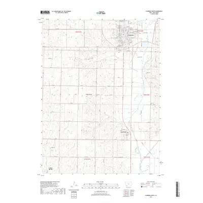
2018 Map of Clarinda South
USGS Topo · Published 2018About this map
Clarinda anchors the northern edge of this Page County survey, where the N Br W Nodaway River and S Br W Nodaway River converge to form the West Nodaway River. The terrain is characterized by the complex drainage systems of No Business Cr and the various branches of Mill Creek, including W Mill Cr and Middle Mill Cr. This 2018 data illustrates the modern agricultural landscape surrounding the smaller settlements of Shambaugh and College Springs. For local historians and genealogists, the map identifies several rural burying grounds that provide a record of early settlement patterns, such as Lee Grove Cem, Covenanter Cem, and Butler Cem. The southern reach of the quadrangle shows the confluence of the West and East Nodaway River, marking a significant topographical junction in the regional river system.
Find a feature on this map
110 named features on this map. Tap any name to fly to it.
Don’t see what you’re looking for? This feature index may not catch every label — zoom into the map to look around manually.
Map Details
Editions of this 2018 Clarinda South Map
This is the sole edition of this map. No revisions or reprints were ever made.
Other maps of this area

1940 · Coin
USGS Topo · 1:62,500

1940 · New Market
USGS Topo · 1:62,500

1943 · Coin
USGS Topo · 1:62,500

1943 · New Market
USGS Topo · 1:62,500

1955 · Nebraska City
USGS Topo · 1:250,000

1957 · Nebraska City
USGS Topo · 1:250,000

1958 · Nebraska City
USGS Topo · 1:250,000

1978 · Stanton SW
USGS Topo · 1:24,000

1978 · Clarinda North
USGS Topo · 1:24,000
1980 · Hopkins SW
USGS Topo · 1:24,000