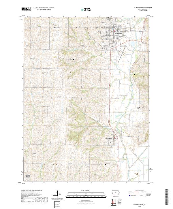
2022 Map of Clarinda South
USGS Topo · Published 2022About this map
The Page County Courthouse anchors the southern portion of Clarinda, marking the regional importance of this county seat along the Nodaway River drainage. This 2022 survey captures the transition from the city's structured grid, featuring the Iowa Western Community College Clarinda Center, to the rural agricultural landscape of Page County. The terrain is defined by the winding paths of S Br W Nodaway River and No Business Cr, which cut through the rolling Iowa farmland.
Find a feature on this map
68 named features on this map. Tap any name to fly to it.
Don’t see what you’re looking for? This feature index may not catch every label — zoom into the map to look around manually.
Map Details
Editions of this 2022 Clarinda South Map
This is the sole edition of this map. No revisions or reprints were ever made.
Other maps of this area

1940 · Coin
USGS Topo · 1:62,500

1940 · New Market
USGS Topo · 1:62,500

1943 · Coin
USGS Topo · 1:62,500

1943 · New Market
USGS Topo · 1:62,500

1955 · Nebraska City
USGS Topo · 1:250,000

1957 · Nebraska City
USGS Topo · 1:250,000

1958 · Nebraska City
USGS Topo · 1:250,000

1978 · Stanton SW
USGS Topo · 1:24,000

1978 · Clarinda North
USGS Topo · 1:24,000
1980 · Hopkins SW
USGS Topo · 1:24,000