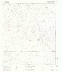
1964 Map of Clark Brothers Ranch
USGS Topo · Published 1981About this map
Industrial activity and ranching operations intersect in this mid-century survey of the Ector and Crane County line. The landscape is dominated by the sprawling infrastructure of the South Cowden Oil Field, Double Oil Field, and Edwards Oil Field, where numerous Oil Wells and a dense network of pipelines and unimproved roads trace the development of the Permian Basin. This energy-focused footprint is overlaid upon traditional cattle country, defined by the namesake Clark Brothers Ranch and the Rodman Ranch.
Find a feature on this map
22 named features on this map. Tap any name to fly to it.
Don’t see what you’re looking for? This feature index may not catch every label — zoom into the map to look around manually.
Map Details
Editions of this 1964 Clark Brothers Ranch Map
2 editions found
Other maps of this area

1954 · Pecos
USGS Topo · 1:250,000

1957 · Pecos
USGS Topo · 1:250,000

1964 · Odessa SW
USGS Topo · 1:24,000

1964 · Odessa SE
USGS Topo · 1:24,000

1964 · Douro
USGS Topo · 1:24,000

1964 · Doodle Bug Well
USGS Topo · 1:24,000

1964 · Penwell
USGS Topo · 1:24,000

1964 · Penwell SE
USGS Topo · 1:24,000

1964 · Clark Brothers Ranch
USGS Topo · 1:24,000

1964 · Perkins Lake
USGS Topo · 1:24,000