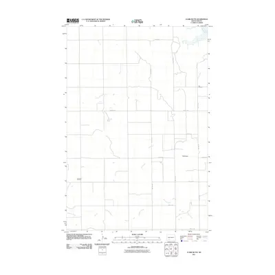
2011 Map of Clark Butte
USGS Topo · Published 2011About this map
Clark Butte rises above the prairie in this section of Grant County, where the landscape is defined by the winding paths of Coal Creek and Antelope Creek. This 2011 survey reveals a quiet agricultural region organized by a strict grid of section-line roads, including Newburg Rd and 60th St SW. The area's settlement history is anchored by the presence of Zion Cemetery in the northeast and Freidenfeld Cemetery to the west, markers of the local community and genealogy. To the north, the Heart River and Spring Creek influence the local drainage patterns. The lack of concentrated town sites emphasizes the rural character of this North Dakota landscape, where land use revolves around the natural topography of the buttes and the seasonal flow of its prairie creeks.
Find a feature on this map
18 named features on this map. Tap any name to fly to it.
Don’t see what you’re looking for? This feature index may not catch every label — zoom into the map to look around manually.
Map Details
Editions of this 2011 Clark Butte Map
This is the sole edition of this map. No revisions or reprints were ever made.
Other maps of this area

1938 · Heart Butte
USGS Topo · 1:48,000

1944 · Heart Butte
USGS Topo · 1:62,500

1953 · Dickinson
USGS Topo · 1:250,000

1954 · Bismarck
USGS Topo · 1:250,000

1957 · Dickinson
USGS Topo · 1:250,000

1958 · Bismarck
USGS Topo · 1:250,000

1960 · Clark Butte NW
USGS Topo · 1:24,000

1960 · Heart Butte NW
USGS Topo · 1:24,000

1960 · Clark Butte NE
USGS Topo · 1:24,000

1960 · Clark Butte SW
USGS Topo · 1:24,000