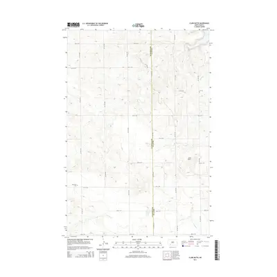
2014 Map of Clark Butte
USGS Topo · Published 2014About this map
Clark Butte rises as a prominent landmark in this upland landscape straddling the boundary of Grant and Hettinger counties. The terrain is defined by a series of drainage systems, including the Heart River in the northeast and Antelope Cr to the south. This 2014 survey documents a strictly rural section of North Dakota, where the grid of section roads like 81st Ave SW and 55th St SW organizes the expansive prairie. For genealogists, the map identifies localized burial sites such as Zion Cem and Freidenfeld Cem, which serve as some of the only named indicators of the area's early settlement history. The course of Coal Cr and Spring Cr further illustrate the watershed patterns that shaped the placement of local homesteads and travel routes across these high plains.
Find a feature on this map
23 named features on this map. Tap any name to fly to it.
Don’t see what you’re looking for? This feature index may not catch every label — zoom into the map to look around manually.
Map Details
Editions of this 2014 Clark Butte Map
This is the sole edition of this map. No revisions or reprints were ever made.
Other maps of this area

1938 · Heart Butte
USGS Topo · 1:48,000

1944 · Heart Butte
USGS Topo · 1:62,500

1953 · Dickinson
USGS Topo · 1:250,000

1954 · Bismarck
USGS Topo · 1:250,000

1957 · Dickinson
USGS Topo · 1:250,000

1958 · Bismarck
USGS Topo · 1:250,000

1960 · Clark Butte NW
USGS Topo · 1:24,000

1960 · Heart Butte NW
USGS Topo · 1:24,000

1960 · Clark Butte NE
USGS Topo · 1:24,000

1960 · Clark Butte SW
USGS Topo · 1:24,000