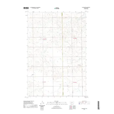
2020 Map of Clark Butte
USGS Topo · Published 2020About this map
Freidenfeld Cem stands as a quiet focal point in this section of the northern plains, located just south of the winding course of Coal Creek. The landscape is defined by the high prominence of Clark Butte, which overlooks the intersection of the modern grid of rural roads including 76th Ave SW and 59th St SW. The area transitions from the drainage of Spring Creek in the northeast toward the southern flow of Antelope Creek, illustrating the natural water sheds that have guided ranching and agriculture across the Grant and Hettinger county line. This survey shows the persistent structure of the Public Land Survey System, with the townships of t136n r91w and t135n r90w clearly demarcated, providing a precise look at the land partitions used by generations of homesteaders.
Find a feature on this map
21 named features on this map. Tap any name to fly to it.
Don’t see what you’re looking for? This feature index may not catch every label — zoom into the map to look around manually.
Map Details
Editions of this 2020 Clark Butte Map
This is the sole edition of this map. No revisions or reprints were ever made.
Other maps of this area

1938 · Heart Butte
USGS Topo · 1:48,000

1944 · Heart Butte
USGS Topo · 1:62,500

1953 · Dickinson
USGS Topo · 1:250,000

1954 · Bismarck
USGS Topo · 1:250,000

1957 · Dickinson
USGS Topo · 1:250,000

1958 · Bismarck
USGS Topo · 1:250,000

1960 · Clark Butte NW
USGS Topo · 1:24,000

1960 · Heart Butte NW
USGS Topo · 1:24,000

1960 · Clark Butte NE
USGS Topo · 1:24,000

1960 · Clark Butte SW
USGS Topo · 1:24,000