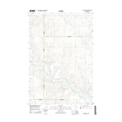
2014 Map of Clark Butte NE
USGS Topo · Published 2014About this map
The Heart River meanders through this portion of the North Dakota plains, carving a distinct valley across a landscape primarily defined by a rigid grid of section-line roads. This survey reveals the convergence of several county boundaries, where Stark, Morton, Grant, and Hettinger counties meet. The drainage pattern is led by the river and its local tributaries, including Beaver Cr and Peters Cr, which cut through the undulating terrain. Apart from the natural watercourses, the map is dominated by the rural infrastructure of the early 21st century, documented through a series of numbered local routes such as 77 1/2 Ave and 54th St Sw. The absence of concentrated town centers highlights the area's character as a vast agricultural expanse where transportation is governed by long, straight avenues like 81st Ave Sw and 75th Ave Sw.
Find a feature on this map
29 named features on this map. Tap any name to fly to it.
Don’t see what you’re looking for? This feature index may not catch every label — zoom into the map to look around manually.
Map Details
Editions of this 2014 Clark Butte NE Map
This is the sole edition of this map. No revisions or reprints were ever made.
Other maps of this area

1938 · Heart Butte
USGS Topo · 1:48,000

1944 · Heart Butte
USGS Topo · 1:62,500

1953 · Dickinson
USGS Topo · 1:250,000

1954 · Bismarck
USGS Topo · 1:250,000

1957 · Dickinson
USGS Topo · 1:250,000

1958 · Bismarck
USGS Topo · 1:250,000

1960 · Clark Butte NW
USGS Topo · 1:24,000

1960 · Heart Butte NW
USGS Topo · 1:24,000

1960 · Clark Butte NE
USGS Topo · 1:24,000

1960 · Clark Butte SW
USGS Topo · 1:24,000