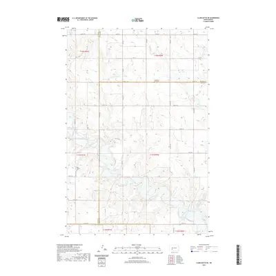
2020 Map of Clark Butte NE
USGS Topo · Published 2020About this map
The Heart River meanders across this prairie landscape where Stark, Morton, Grant, and Hettinger counties meet. This contemporary survey of the Clark Butte NE region shows a rural environment defined by its section-line road network, including arterial routes like Co Rd 138 and 47th St SW. The area's settlement history is anchored by its remote country burial grounds, specifically Christ Lutheran Cem in the southwest and Saints Peter and Paul Cem to the north. These sites, along with the drainage patterns of Beaver Cr and Peters Cr, provide essential landmarks for genealogists and local historians tracing family lineages in this corner of North Dakota. The map detail highlights the persistent agricultural character of the region, where township boundaries and rural avenues like 78th Ave SW remain the primary framework of the land.
Find a feature on this map
38 named features on this map. Tap any name to fly to it.
Don’t see what you’re looking for? This feature index may not catch every label — zoom into the map to look around manually.
Map Details
Editions of this 2020 Clark Butte NE Map
This is the sole edition of this map. No revisions or reprints were ever made.
Other maps of this area

1938 · Heart Butte
USGS Topo · 1:48,000

1944 · Heart Butte
USGS Topo · 1:62,500

1953 · Dickinson
USGS Topo · 1:250,000

1954 · Bismarck
USGS Topo · 1:250,000

1957 · Dickinson
USGS Topo · 1:250,000

1958 · Bismarck
USGS Topo · 1:250,000

1960 · Clark Butte NW
USGS Topo · 1:24,000

1960 · Heart Butte NW
USGS Topo · 1:24,000

1960 · Clark Butte NE
USGS Topo · 1:24,000

1960 · Clark Butte SW
USGS Topo · 1:24,000