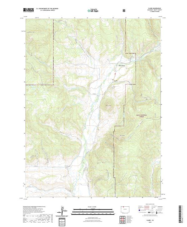
2022 Map of Clark
USGS Topo · Published 2022About this map
The Elk River serves as the central artery for this mountainous region of Routt County, where the small settlements of Glen Eden and Clark provide the primary hubs for local activity. The landscape is defined by the transition from high peaks like McAlpin Mtn to the deep incisions of Taylor Canyon and the appropriately named Impassable Canyon. A complex network of irrigation infrastructure, including the Murphy Ditch, Sand Cr Ditch, and Frantz Ditch, illustrates the historical effort to manage water resources for the valleys below. In the east, the boundaries of the Routt National Forest encompass steep terrain and high drainage basins like Long Draw. Natural landmarks such as Pond Lily Lakes and Round Mtn dot the area, connected by a system of rural routes and trails like CO Rte 129 and the McAlpin Trl.
Find a feature on this map
53 named features on this map. Tap any name to fly to it.
Don’t see what you’re looking for? This feature index may not catch every label — zoom into the map to look around manually.
Map Details
Editions of this 2022 Clark Map
This is the sole edition of this map. No revisions or reprints were ever made.
Other maps of this area

1911 · Hahns Peak
USGS Topo · 1:125,000

1913 · Hahns Peak
USGS Topo · 1:125,000

1923 · Pilot Knob
USGS Topo · 1:62,500

1925 · Pilot Knob
USGS Topo · 1:62,500

1954 · Craig
USGS Topo · 1:250,000

1957 · Craig
USGS Topo · 1:250,000

1958 · Craig
USGS Topo · 1:250,000

1960 · Craig
USGS Topo · 1:250,000

1962 · Craig
USGS Topo · 1:250,000
1962 · Rocky Peak
USGS Topo · 1:24,000