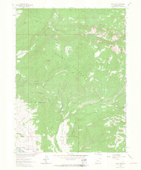
1962 Map of Rocky Peak
USGS Topo · Published 1964About this map
Strawberry Park and the surrounding wilderness of the Routt National Forest dominate this early 1960s survey, revealing a landscape defined by drainage networks and early recreation infrastructure. In the southwest, the Yampa River flows near the D & R G W railroad line and the Steamboat Springs Airport, marking the edge of local transit and commerce. The presence of a Gravel Pit and numerous water management features like the Highline Ditch suggest the ongoing development of the valley's resources for nearby settlements.
Find a feature on this map
32 named features on this map. Tap any name to fly to it.
Don’t see what you’re looking for? This feature index may not catch every label — zoom into the map to look around manually.
Map Details
Editions of this 1962 Rocky Peak Map
3 editions found
Other maps of this area

1911 · Hahns Peak
USGS Topo · 1:125,000

1913 · Hahns Peak
USGS Topo · 1:125,000

1954 · Craig
USGS Topo · 1:250,000

1955 · Buffalo Pass
USGS Topo · 1:24,000

1955 · Mount Ethel
USGS Topo · 1:24,000

1955 · Mount Ethel
USGS Topo · 1:62,500

1956 · Storm Mountain
USGS Topo · 1:24,000

1956 · Rabbit Ears Peak
USGS Topo · 1:62,500

1957 · Craig
USGS Topo · 1:250,000

1958 · Craig
USGS Topo · 1:250,000