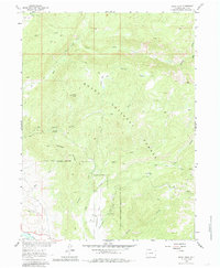
1962 Map of Rocky Peak
USGS Topo · Published 1985About this map
Routt National Forest dominates this Colorado landscape, characterized by a complex drainage network that feeds into the Yampa River at the southwestern corner of the sheet. The terrain rises sharply toward Rocky Peak and Copper Ridge, while water management is evidenced by the Highline Ditch winding through the hills. This 1962 field-checked survey reveals the mid-century infrastructure supporting both aviation and recreation, including the Steamboat Springs Airport and the Dry Lake Campground. For those tracing historical land use, the map details numerous unnamed trails, a Lookout Tower, and localized features like Butchersnife and Mad Creek, illustrating how the region's geography dictated early transit and settlement patterns near the forest boundaries.
Find a feature on this map
33 named features on this map. Tap any name to fly to it.
Don’t see what you’re looking for? This feature index may not catch every label — zoom into the map to look around manually.
Map Details
Editions of this 1962 Rocky Peak Map
3 editions found
Other maps of this area

1911 · Hahns Peak
USGS Topo · 1:125,000

1913 · Hahns Peak
USGS Topo · 1:125,000

1954 · Craig
USGS Topo · 1:250,000

1955 · Buffalo Pass
USGS Topo · 1:24,000

1955 · Mount Ethel
USGS Topo · 1:24,000

1955 · Mount Ethel
USGS Topo · 1:62,500

1956 · Storm Mountain
USGS Topo · 1:24,000

1956 · Rabbit Ears Peak
USGS Topo · 1:62,500

1957 · Craig
USGS Topo · 1:250,000

1958 · Craig
USGS Topo · 1:250,000