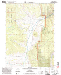
2000 Map of Clark
USGS Topo · Published 2004About this map
The Elk River valley serves as the central artery for this high-country landscape, where the small settlements of Clark and Glen Eden are situated. Large portions of the terrain fall within the Routt National Forest, characterized by numerous drainages such as Cottonwood Gulch, Dutch Gulch, and Long Gulch. The map reveals a history of resource extraction and community infrastructure, notably the Greenville Mine and the local Moon Hill Sch.
Find a feature on this map
40 named features on this map. Tap any name to fly to it.
Don’t see what you’re looking for? This feature index may not catch every label — zoom into the map to look around manually.
Map Details
Editions of this 2000 Clark Map
This is the sole edition of this map. No revisions or reprints were ever made.
Other maps of this area

1911 · Hahns Peak
USGS Topo · 1:125,000

1913 · Hahns Peak
USGS Topo · 1:125,000

1923 · Pilot Knob
USGS Topo · 1:62,500

1925 · Pilot Knob
USGS Topo · 1:62,500

1954 · Craig
USGS Topo · 1:250,000

1957 · Craig
USGS Topo · 1:250,000

1958 · Craig
USGS Topo · 1:250,000

1960 · Craig
USGS Topo · 1:250,000

1962 · Craig
USGS Topo · 1:250,000
1962 · Rocky Peak
USGS Topo · 1:24,000