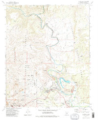
1973 Map of Clarkdale
USGS Topo · Published 1983About this map
The heavy industrial footprint of copper mining defines this landscape in the early 1970s, where the United Verde Mine and its network of infrastructure dominate the southwestern terrain near Clarkdale. Significant underground operations are marked by the Hopewell Tunnel, Josephine Tunnel, and Dundee Shaft, while the Atchison Topeka and Santa Fe Railroad winds through the hills to serve the smelter operations evidenced by extensive mill tailings and Settling Ponds.
Find a feature on this map
73 named features on this map. Tap any name to fly to it.
Don’t see what you’re looking for? This feature index may not catch every label — zoom into the map to look around manually.
Map Details
Editions of this 1973 Clarkdale Map
3 editions found
Other maps of this area

1887 · Verde
USGS Topo · 1:250,000

1887 · Prescott
USGS Topo · 1:250,000

1892 · Verde
USGS Topo · 1:250,000

1892 · Prescott
USGS Topo · 1:250,000

1905 · Jerome
USGS Topo · 1:125,000

1923 · Camp Verde
USGS Topo · 1:125,000

1932 · Camp Verde
USGS Topo · 1:125,000

1936 · Camp Verde
USGS Topo · 1:125,000

1944 · Clarkdale
USGS Topo · 1:48,000

1944 · Mingus Mountain
USGS Topo · 1:62,500