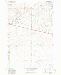
1962 Map of Clarke
USGS Topo · Published 1980About this map
Clarke and the surrounding high desert of Morrow County are defined by mid-century military and transport infrastructure in this detailed survey. The landscape is dominated by the northern reaches of the Boardman Bombing Range and the western edge of the Umatilla Ordnance Depot, indicating the era's significant federal presence in the region. Transportation routes are equally prominent, with the Union Pacific line passing through Boardman Junction alongside the West Extension and Paterson Ferry Road. This period shows a transition from traditional water sources like Coyote Spring and Lower Sand Spring to engineered solutions like the Irrigation Canal. For the traveler, the Boardman Oasis Roadside Rest provided a stop along the highway, while a remote Radio Facility served as a modern landmark in the open terrain.
Find a feature on this map
19 named features on this map. Tap any name to fly to it.
Don’t see what you’re looking for? This feature index may not catch every label — zoom into the map to look around manually.
Map Details
Editions of this 1962 Clarke Map
3 editions found
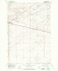
Other maps of this area

1906 · Blalock Island
USGS Topo · 1:125,000

1908 · Blalock Island
USGS Topo · 1:125,000

1908 · Umatilla
USGS Topo · 1:125,000

1953 · Pendleton
USGS Topo · 1:250,000

1956 · Pendleton
USGS Topo · 1:250,000

1962 · Blalock Island
USGS Topo · 1:24,000

1962 · Ordnance
USGS Topo · 1:24,000

1962 · Paterson
USGS Topo · 1:24,000

1962 · Boardman
USGS Topo · 1:24,000

1962 · Clarke
USGS Topo · 1:24,000