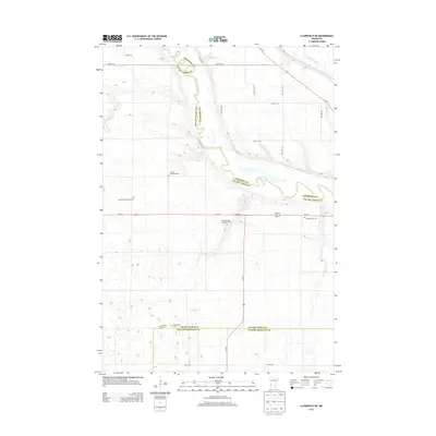
2013 Map of Clarkfield NE
USGS Topo · Published 2013About this map
The Minnesota River meanders through this agricultural landscape at the convergence of three counties: Lac qui Parle, Chippewa, and Yellow Medicine. The river valley is a focal point for local history, featuring the Camp Release Township Cem which recalls the area's early frontier heritage. North of this site, the Chippewa River joins the larger waterway. The land is primarily organized by a grid of rural roads, such as 80th Ave SW and 20th St SW, which connect various family and community burial grounds. Genealogists may find interest in specific sites like the Sommerfeld Family Cem or the German American Cem. Toward the southern boundary, the Saint Petri Cem W and Saint Petri Cem E flank the roadway, serving as quiet markers of the region's Lutheran immigrant roots and established farming townships.
Find a feature on this map
24 named features on this map. Tap any name to fly to it.
Don’t see what you’re looking for? This feature index may not catch every label — zoom into the map to look around manually.
Map Details
Editions of this 2013 Clarkfield NE Map
This is the sole edition of this map. No revisions or reprints were ever made.
Other maps of this area

1953 · New Ulm
USGS Topo · 1:250,000

1953 · Saint Cloud
USGS Topo · 1:250,000

1957 · Saint Cloud
USGS Topo · 1:250,000

1957 · New Ulm
USGS Topo · 1:250,000

1958 · New Ulm
USGS Topo · 1:250,000

1958 · Saint Cloud
USGS Topo · 1:250,000

1958 · Milan
USGS Topo · 1:24,000

1958 · Watson
USGS Topo · 1:24,000

1958 · Gracelock SW
USGS Topo · 1:24,000

1965 · Montevideo
USGS Topo · 1:24,000