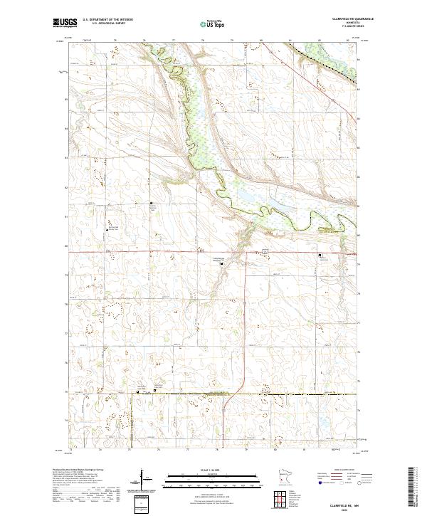
2022 Map of Clarkfield NE
USGS Topo · Published 2022About this map
The Minnesota River carves a winding path through this corner of western Minnesota, where its valley serves as the political boundary for Lac Qui Parle Co, Chippewa Co, and Yellow Medicine Co. The convergence of the Chippewa River into the larger valley creates a complex network of wetlands and wooded breaks among the surrounding agricultural uplands. This area is characterized by its deep-rooted rural community life, evidenced by a high density of local burying grounds including the German American Cem, Sommerfeld Family Cem, and Camp Release Township Cem. For genealogists, the proximity of the Saint Petri Cem West and Saint Petri Cem East near Co HWY 8 provides a specific point of interest for tracing early settlement patterns along the river bluffs. This 2022 survey details the modern road grid, from Co Hwy 79 to the scenic Minnesota River Dr Sw.
Find a feature on this map
53 named features on this map. Tap any name to fly to it.
Don’t see what you’re looking for? This feature index may not catch every label — zoom into the map to look around manually.
Map Details
Editions of this 2022 Clarkfield NE Map
This is the sole edition of this map. No revisions or reprints were ever made.
Other maps of this area

1953 · New Ulm
USGS Topo · 1:250,000

1953 · Saint Cloud
USGS Topo · 1:250,000

1957 · Saint Cloud
USGS Topo · 1:250,000

1957 · New Ulm
USGS Topo · 1:250,000

1958 · New Ulm
USGS Topo · 1:250,000

1958 · Saint Cloud
USGS Topo · 1:250,000

1958 · Milan
USGS Topo · 1:24,000

1958 · Watson
USGS Topo · 1:24,000

1958 · Gracelock SW
USGS Topo · 1:24,000

1965 · Montevideo
USGS Topo · 1:24,000