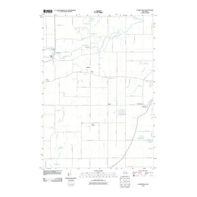
2010 Map of Clarks Mills
USGS Topo · Published 2010About this map
The Manitowoc River meanders through the northern section of this landscape, controlled by the Oslo Dam and Clarks Mill Dam near the settlement of Clarks Mills. This area of Manitowoc County is characterized by its numerous small glacial lakes and a strong foundation of rural community centers. Scattered across the township are vital historical anchors, including Saint Mary Cemetery, Gjerpen Cemetery, and the Saint John Evangelical Lutheran Cemetery near Newtonburg. The map reveals a transition between established agricultural land and small pockets of residential development, with minor hubs like Madsen and Rube serving as local landmarks. Large water bodies such as English Lake, Carstens Lake, and Waack Lake are prominent features in the southern half of the quadrangle, illustrating the importance of these basins to the local topography and recreation.
Find a feature on this map
74 named features on this map. Tap any name to fly to it.
Don’t see what you’re looking for? This feature index may not catch every label — zoom into the map to look around manually.
Map Details
Editions of this 2010 Clarks Mills Map
This is the sole edition of this map. No revisions or reprints were ever made.
Other maps of this area

1954 · School Hill
USGS Topo · 1:24,000

1954 · Manitowoc
USGS Topo · 1:62,500

1954 · Cleveland
USGS Topo · 1:24,000

1954 · St. Wendel
USGS Topo · 1:24,000

1954 · Sheboygan North
USGS Topo · 1:62,500

1954 · Howards Grove
USGS Topo · 1:62,500

1954 · Reedsville
USGS Topo · 1:62,500

1954 · Manitowoc
USGS Topo · 1:24,000

1954 · Milwaukee
USGS Topo · 1:250,000

1954 · Manitowoc
USGS Topo · 1:250,000