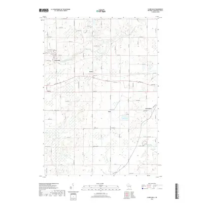
2018 Map of Clarks Mills
USGS Topo · Published 2018About this map
The Manitowoc River meanders through this portion of Manitowoc County, anchoring a landscape defined by small crossroads settlements and numerous rural cemeteries. The community of Clarks Mills sits at a bend in the river, while Madsen, Valders, Rube, and Newtonburg are situated among a patchwork of wetlands and glaciated terrain. This 2018 survey reveals a high density of burial sites that trace the region's cultural heritage, including Saint Mary Cem, Gjerpen Cem, and the Trinity Lutheran Cem. Small kettle lakes and marshes such as English Lake, Vetting Lake, and Waack Lake dot the countryside, connected by minor tributaries like Silver Cr and Pine Cr. The local road network, featuring names like Old Irish Rd and Hempton Lake Rd, suggests the deep-seated family and ethnic ties that have shaped these farming communities for generations.
Find a feature on this map
95 named features on this map. Tap any name to fly to it.
Don’t see what you’re looking for? This feature index may not catch every label — zoom into the map to look around manually.
Map Details
Editions of this 2018 Clarks Mills Map
This is the sole edition of this map. No revisions or reprints were ever made.
Other maps of this area

1954 · School Hill
USGS Topo · 1:24,000

1954 · Manitowoc
USGS Topo · 1:62,500

1954 · Cleveland
USGS Topo · 1:24,000

1954 · St. Wendel
USGS Topo · 1:24,000

1954 · Sheboygan North
USGS Topo · 1:62,500

1954 · Howards Grove
USGS Topo · 1:62,500

1954 · Reedsville
USGS Topo · 1:62,500

1954 · Manitowoc
USGS Topo · 1:24,000

1954 · Milwaukee
USGS Topo · 1:250,000

1954 · Manitowoc
USGS Topo · 1:250,000