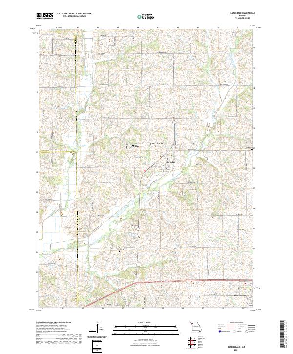
2021 Map of Clarksdale
USGS Topo · Published 2021About this map
Clarksdale and Stewartsville anchor this Missouri landscape where the borders of Andrew, Buchanan, and DeKalb counties meet. The terrain is defined by the winding paths of Third Fork and Little Third Fork, which drain a network of agricultural lands connected by an extensive grid of secondary roads such as SW Ketchem Rd and SW Grindstone Rd. This corner of Northwest Missouri preserves a high density of small family and community burial grounds, including Stone Cem, Silver Cem, and Todd Cem, which are often located on high ground away from the main settlements. The area around Peterson Lake and the various branches like Bays Br and Morgan Br illustrate the intricate drainage patterns that have shaped local farming and property boundaries for generations.
Find a feature on this map
67 named features on this map. Tap any name to fly to it.
Don’t see what you’re looking for? This feature index may not catch every label — zoom into the map to look around manually.
Map Details
Editions of this 2021 Clarksdale Map
This is the sole edition of this map. No revisions or reprints were ever made.
Other maps of this area

1923 · Clarksdale
USGS Topo · 1:62,500

1923 · Maysville
USGS Topo · 1:62,500

1925 · Gower
USGS Topo · 1:62,500

1925 · Clarksdale
USGS Topo · 1:62,500

1925 · Plattsburg
USGS Topo · 1:62,500

1925 · Maysville
USGS Topo · 1:62,500

1950 · Kansas City
USGS Topo · 1:250,000

1954 · Kansas City
USGS Topo · 1:250,000

1956 · Kansas City
USGS Topo · 1:250,000

1960 · Kansas City
USGS Topo · 1:250,000