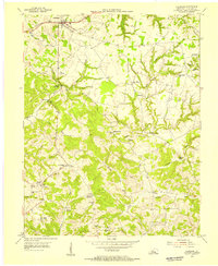
1954 Map of Clarkson
USGS Topo · Published 1955About this map
The Illinois Central railroad corridor anchors the northern edge of this mid-century survey, passing through the established community of Clarkson. From this transit spine, the landscape transitions into a complex network of ridges and hollows defined by the drainage of Bear Creek and Conoloway Creek. These rugged contours preserved a series of localized rural settlements, including Grayson Springs and Skaggstown, which remained central to the region's social geography into the 1950s.
Find a feature on this map
41 named features on this map. Tap any name to fly to it.
Don’t see what you’re looking for? This feature index may not catch every label — zoom into the map to look around manually.
Map Details
Editions of this 1954 Clarkson Map
This is the sole edition of this map. No revisions or reprints were ever made.
Other maps of this area

1922 · Leitchfield
USGS Topo · 1:48,000

1925 · Cub Run
USGS Topo · 1:62,500

1925 · Leitchfield
USGS Topo · 1:62,500

1932 · Big Clifty
USGS Topo · 1:62,500

1949 · Summit
USGS Topo · 1:24,000

1949 · Big Clifty
USGS Topo · 1:24,000

1949 · Big Clifty
USGS Topo · 1:62,500

1953 · Bee Spring
USGS Topo · 1:24,000

1954 · Evansville
USGS Topo · 1:250,000
1954 · Dickeys Mills
USGS Topo · 1:24,000