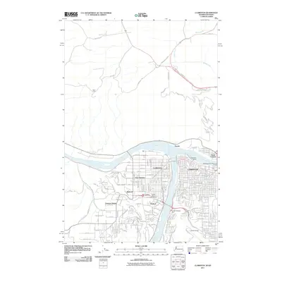
2011 Map of Clarkston
USGS Topo · Published 2011About this map
The Snake River and Clearwater River converge at the heart of this Pacific Northwest landscape, defining the layout of Lewiston, Idaho, and Clarkston, Washington. In the early 21st century, these riverfront cities show a dense network of residential and industrial streets, connected by the Clearwater River Memorial Bridge. The map highlights the diverse transportation infrastructure of the valley, from the Lewiston Airport on the southern plateau to the Snake River Seaplane Base on the water. Beyond the urban centers, the terrain rises sharply toward the Stout Ranch and the winding Old Spiral Hwy, illustrating the transition from the river valley to the surrounding plateaus. Local history is anchored by sites like Vineland Cemetery and neighborhoods such as Clarkston Heights, while the Sunset Palisades Dam reflects the region's managed water resources.
Find a feature on this map
129 named features on this map. Tap any name to fly to it.
Don’t see what you’re looking for? This feature index may not catch every label — zoom into the map to look around manually.
Map Details
Editions of this 2011 Clarkston Map
This is the sole edition of this map. No revisions or reprints were ever made.
Other maps of this area

1910 · Pullman
USGS Topo · 1:125,000

1945 · Clarkston
USGS Topo · 1:62,500

1948 · Clarkston
USGS Topo · 1:62,500

1955 · Pullman
USGS Topo · 1:250,000

1958 · Pullman
USGS Topo · 1:250,000

1958 · Lewiston Orchards North
USGS Topo · 1:24,000

1958 · Lewiston Orchards South
USGS Topo · 1:24,000

1958 · Lewiston Orchards
USGS Topo · 1:62,500

1961 · Moscow
USGS Topo · 1:62,500

1964 · Colton
USGS Topo · 1:24,000