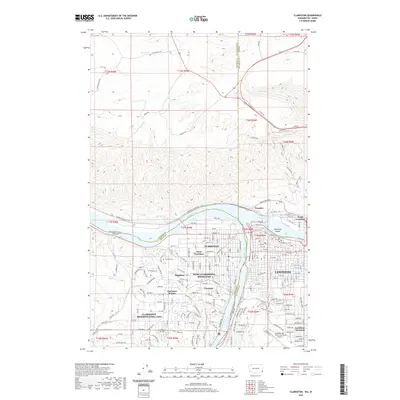
2020 Map of Clarkston
USGS Topo · Published 2020About this map
The Snake River and Clearwater River converge at the heart of this 2020 landscape, defining the state boundary between Washington and Idaho. On the western bank, the city of Clarkston and its surrounding communities, including West Clarkston-Highland and Clarkston Heights-Vineland, occupy the level benches and rising slopes of the valley. Local history is anchored at the Vineland Cem, while the industrial and transport legacy of the region is evident at the Transfer area and along Railroad Ave. Across the water in Idaho, Lewiston and North Lewiston flank the river junction, supported by the sprawling infrastructure of the Lewiston-Nez Perce County Airport. The terrain north of the rivers is marked by dramatic elevation changes, notably traced by the Old Spiral Hwy as it climbs the ridges overlooking Holbrook Island and the river valley below.
Find a feature on this map
54 named features on this map. Tap any name to fly to it.
Don’t see what you’re looking for? This feature index may not catch every label — zoom into the map to look around manually.
Map Details
Editions of this 2020 Clarkston Map
This is the sole edition of this map. No revisions or reprints were ever made.
Other maps of this area

1910 · Pullman
USGS Topo · 1:125,000

1945 · Clarkston
USGS Topo · 1:62,500

1948 · Clarkston
USGS Topo · 1:62,500

1955 · Pullman
USGS Topo · 1:250,000

1958 · Pullman
USGS Topo · 1:250,000

1958 · Lewiston Orchards North
USGS Topo · 1:24,000

1958 · Lewiston Orchards South
USGS Topo · 1:24,000

1958 · Lewiston Orchards
USGS Topo · 1:62,500

1961 · Moscow
USGS Topo · 1:62,500

1964 · Colton
USGS Topo · 1:24,000