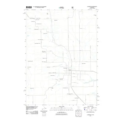
2011 Map of Clarkston
USGS Topo · Published 2011About this map
Clarkston sits at the foot of the Malad Range, where the high peaks of Clarkston Mountain and Gunsight Peak give way to a complex system of canyons and hollows. This 2011 survey by the U.S. Geological Survey illustrates a landscape defined by water management and topography, from the drainage of Birch Creek and City Creek to the marshy expanse of The Slough in the southeast. Numerous springs, including Kinnikinnick Spring, Casper Spring, and Gunsight Spring, suggest the critical importance of water sources in this high-altitude environment.
Find a feature on this map
74 named features on this map. Tap any name to fly to it.
Don’t see what you’re looking for? This feature index may not catch every label — zoom into the map to look around manually.
Map Details
Editions of this 2011 Clarkston Map
This is the sole edition of this map. No revisions or reprints were ever made.
Other maps of this area

1914 · Logan
USGS Topo · 1:125,000

1915 · Preston
USGS Topo · 1:96,000

1916 · Logan
USGS Topo · 1:125,000

1918 · Preston
USGS Topo · 1:125,000

1954 · Pocatello
USGS Topo · 1:250,000

1954 · Ogden
USGS Topo · 1:250,000

1954 · Brigham City
USGS Topo · 1:250,000

1955 · Preston
USGS Topo · 1:250,000

1958 · Ogden
USGS Topo · 1:250,000

1958 · Pocatello
USGS Topo · 1:250,000