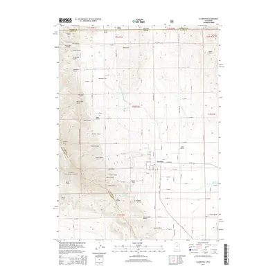
2014 Map of Clarkston
USGS Topo · Published 2014About this map
Clarkston serves as the central hub of this northern Cache County landscape, where the flat agricultural basins of the east meet the steep drainages of the Caribou National Forest to the west. This 2014 survey captures a terrain defined by deep canyons and family-named hollows, including Al Archibald Hollow and Bob Archibald Hollow, illustrating the enduring local history of the area's settlers. The transition from the high peaks of Clarkston Mtn down through Straight Canyon and Miller Canyon reveals a complex water system managed through features like Newton Reservoir and The Slough. Notable landmarks like Round Knoll and the Washboards provide distinct navigational points within the surrounding hills. This map documents a modern snapshot of a classic Utah mountain-valley interface, where irrigation from City Cr and Myler Cr supports the grid-patterned fields that surround the town.
Find a feature on this map
88 named features on this map. Tap any name to fly to it.
Don’t see what you’re looking for? This feature index may not catch every label — zoom into the map to look around manually.
Map Details
Editions of this 2014 Clarkston Map
This is the sole edition of this map. No revisions or reprints were ever made.
Other maps of this area

1914 · Logan
USGS Topo · 1:125,000

1915 · Preston
USGS Topo · 1:96,000

1916 · Logan
USGS Topo · 1:125,000

1918 · Preston
USGS Topo · 1:125,000

1954 · Pocatello
USGS Topo · 1:250,000

1954 · Ogden
USGS Topo · 1:250,000

1954 · Brigham City
USGS Topo · 1:250,000

1955 · Preston
USGS Topo · 1:250,000

1958 · Ogden
USGS Topo · 1:250,000

1958 · Pocatello
USGS Topo · 1:250,000