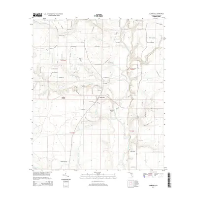
2015 Map of Clarksville
USGS Topo · Published 2015About this map
The Chipola River flows southward through this portion of Calhoun County, defining the drainage patterns for numerous local tributaries like Fourmile Cr and Tenmile Cr. The settlement of Clarksville serves as a central hub, situated near the Clarksville Airport and the junction of several rural routes. Smaller communities such as Rollins Corner and Fisher Corner are positioned to the west, reflecting the area's history of agricultural and timber-related land use.
Find a feature on this map
96 named features on this map. Tap any name to fly to it.
Don’t see what you’re looking for? This feature index may not catch every label — zoom into the map to look around manually.
Map Details
Editions of this 2015 Clarksville Map
This is the sole edition of this map. No revisions or reprints were ever made.
Other maps of this area

1944 · Clarksville
USGS Topo · 1:31,680

1945 · Juniper Creek
USGS Topo · 1:31,680

1945 · Blountstown
USGS Topo · 1:31,680

1945 · Clarksville
USGS Topo · 1:31,680

1945 · Broad Branch
USGS Topo · 1:31,680

1945 · Estiffanulga
USGS Topo · 1:31,680

1945 · Frink
USGS Topo · 1:31,680

1952 · Alford SE
USGS Topo · 1:24,000

1952 · Altha West
USGS Topo · 1:24,000

1952 · Altha East
USGS Topo · 1:24,000