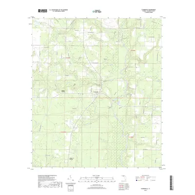
2018 Map of Clarksville
USGS Topo · Published 2018About this map
Clarksville and the surrounding rural landscape of Calhoun County are defined by a dense network of watercourses and agricultural crossroads in this 2018 survey. The Chipola River winds through the eastern portion of the map, fed by numerous named tributaries including Tenmile Cr, Fourmile Cr, and Wildcat Cr. Small settlements and naming conventions like Rollins Corner and Fisher Corner indicate the traditional community hubs of the area, while the Clarksville Airport suggests more modern regional utility. For those researching family history, the map provides precise locations for several small burial grounds such as Ayers Cem, Pippin Cem, and Barfield Cem. The terrain is marked by low-lying wetlands like Buzzard Bay and a complex system of local roads, including NW Shuman Ferry Rd, which points to the era when river crossings were vital to local commerce and travel.
Find a feature on this map
121 named features on this map. Tap any name to fly to it.
Don’t see what you’re looking for? This feature index may not catch every label — zoom into the map to look around manually.
Map Details
Editions of this 2018 Clarksville Map
This is the sole edition of this map. No revisions or reprints were ever made.
Other maps of this area

1944 · Clarksville
USGS Topo · 1:31,680

1945 · Juniper Creek
USGS Topo · 1:31,680

1945 · Blountstown
USGS Topo · 1:31,680

1945 · Clarksville
USGS Topo · 1:31,680

1945 · Broad Branch
USGS Topo · 1:31,680

1945 · Estiffanulga
USGS Topo · 1:31,680

1945 · Frink
USGS Topo · 1:31,680

1952 · Alford SE
USGS Topo · 1:24,000

1952 · Altha West
USGS Topo · 1:24,000

1952 · Altha East
USGS Topo · 1:24,000