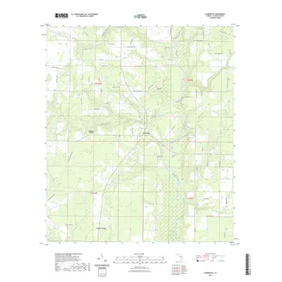
2021 Map of Clarksville
USGS Topo · Published 2021About this map
Clarksville sits at the heart of this Calhoun County landscape, where the Chipola River flows south through a dense network of tributaries including Tenmile Cr and Farley Cr. The map details a rural settlement pattern defined by small intersections like Rollins Corner and Fisher Corner, connected by a web of local roads and family-named routes such as NW Pippen Rd and Hugh Comerford Rd. The winding path of the Chipola River State Trl follows the river's course, highlighting the area's transition into conservation and recreation.
Find a feature on this map
86 named features on this map. Tap any name to fly to it.
Don’t see what you’re looking for? This feature index may not catch every label — zoom into the map to look around manually.
Map Details
Editions of this 2021 Clarksville Map
This is the sole edition of this map. No revisions or reprints were ever made.
Other maps of this area

1944 · Clarksville
USGS Topo · 1:31,680

1945 · Juniper Creek
USGS Topo · 1:31,680

1945 · Blountstown
USGS Topo · 1:31,680

1945 · Clarksville
USGS Topo · 1:31,680

1945 · Broad Branch
USGS Topo · 1:31,680

1945 · Estiffanulga
USGS Topo · 1:31,680

1945 · Frink
USGS Topo · 1:31,680

1952 · Alford SE
USGS Topo · 1:24,000

1952 · Altha West
USGS Topo · 1:24,000

1952 · Altha East
USGS Topo · 1:24,000