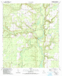
1990 Map of Clarksville
USGS Topo · Published 1990About this map
The Chipola River carves a winding path through the center of this Panhandle landscape, dictating the settlement patterns of central Calhoun County. Small farming communities and family-named junctions such as Rollins Corner and Clarksville are clustered along the Base Line and local routes, while the surrounding pine-rich lowlands are defined by numerous watercourses like Fourmile Creek and Tenmile Creek. Genealogy researchers will find significant value in the high density of rural religious and burial sites, including Abe Springs Ch, Magnolia Ch, and the Ayers Cems. The map also captures local education history at the Carr Sch and industrial remnants like the Claypit near Mayo Mill Branch. Land markers like the Landing Strip and Boat Ramp indicate the modern recreational and utility uses of the river corridor by the late twentieth century.
Find a feature on this map
38 named features on this map. Tap any name to fly to it.
Don’t see what you’re looking for? This feature index may not catch every label — zoom into the map to look around manually.
Map Details
Editions of this 1990 Clarksville Map
This is the sole edition of this map. No revisions or reprints were ever made.
Other maps of this area

1944 · Clarksville
USGS Topo · 1:31,680

1945 · Juniper Creek
USGS Topo · 1:31,680

1945 · Blountstown
USGS Topo · 1:31,680

1945 · Clarksville
USGS Topo · 1:31,680

1945 · Broad Branch
USGS Topo · 1:31,680

1945 · Estiffanulga
USGS Topo · 1:31,680

1945 · Frink
USGS Topo · 1:31,680

1952 · Alford SE
USGS Topo · 1:24,000

1952 · Altha West
USGS Topo · 1:24,000

1952 · Altha East
USGS Topo · 1:24,000