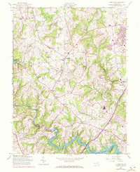
1957 Map of Clarksville
USGS Topo · Published 1972About this map
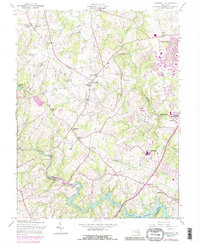
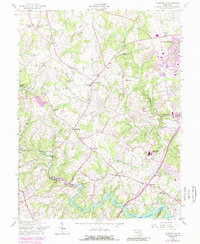
Clarksville and its surrounding rural landscapes are meticulously detailed in this mid-century document, which captures the transition of Howard County before suburban expansion. The terrain is defined by the winding course of the Middle Patuxent River and the significant water bodies of Triadelphia Reservoir and Rocky Gorge Reservoir. These reservoirs shaped the local geography and infrastructure, while various pipelines and a Landing Strip indicate the increasing modernization of the era. Settlement patterns are evidenced by historic community centers like Dayton, Highland, and Simpsonville. Genealogy and local history are preserved through numerous local institutions, including the Linthicum Cemetery, Brown Chapel, and several educational landmarks such as the Hopkins School and Atholton High School. The interplay of agricultural tracts, woodland, and early road networks like Cedar Lane illustrates the area's mid-20th-century character before the significant development of the coming decades.
Find a feature on this map
34 named features on this map. Tap any name to fly to it.
Don’t see what you’re looking for? This feature index may not catch every label — zoom into the map to look around manually.
Map Details
Editions of this 1957 Clarksville Map
6 editions found
Other maps of this area

1892 · Laurel
USGS Topo · 1:62,500

1892 · Ellicott
USGS Topo · 1:62,500

1893 · Frederick
USGS Topo · 1:125,000

1894 · Ellicott
USGS Topo · 1:62,500

1894 · Laurel
USGS Topo · 1:62,500

1894 · Frederick
USGS Topo · 1:125,000

1897 · Laurel
USGS Topo · 1:62,500

1906 · Ellicott
USGS Topo · 1:62,500

1907 · Laurel
USGS Topo · 1:62,500

1908 · Patapsco
USGS Topo · 1:125,000