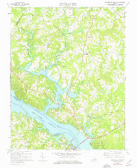
1968 Map of Clarksville North
USGS Topo · Published 1976About this map
The confluence of the Roanoke River and the Dan River dominates this landscape, now transformed by the waters of the John H Kerr Reservoir. The map illustrates the region's adaptation to this major water feature, showing numerous boat ramps and the establishment of the Occoneechee State Park and Marina near Clarksville. Away from the shoreline, the terrain is defined by a network of drainage branches such as Persimmon Tree Branch and Peckerwood Branch that feed into the Bluestone Creek arm of the reservoir.
Find a feature on this map
35 named features on this map. Tap any name to fly to it.
Don’t see what you’re looking for? This feature index may not catch every label — zoom into the map to look around manually.
Map Details
Editions of this 1968 Clarksville North Map
4 editions found
Other maps of this area

1941 · Clarksville
USGS Topo · 1:48,000

1943 · Clarksville
USGS Topo · 1:62,500

1953 · Greensboro
USGS Topo · 1:250,000

1954 · Greensboro
USGS Topo · 1:250,000

1954 · Clover
USGS Topo · 1:62,500

1955 · Chase City
USGS Topo · 1:62,500

1955 · Boydton
USGS Topo · 1:62,500

1957 · Clarksville
USGS Topo · 1:62,500

1962 · Greensboro
USGS Topo · 1:250,000

1966 · Greensboro
USGS Topo · 1:250,000