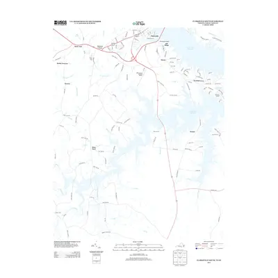
2013 Map of Clarksville South
USGS Topo · Published 2013About this map
John H. Kerr Reservoir dominates the eastern half of this landscape, its irregular shoreline creating a complex network of points and coves where Panhandle Cr and Lick Br meet the main pool. At the northern edge, Clarksville serves as a focal point for the region, supported by local infrastructure like the Clarksville Marina and the nearby Lake Country Regional Airport. The terrain transition is marked by Rosseechees Bluff, which overlooks the water near Mill Village and Blanks. Farther inland, the map captures a series of rural crossroads and historic place-names such as Buffalo Junction, Puryear Corner, and the evocatively named Shiny Rock. This southern Virginia landscape reflects a mix of lakeside residential growth at Merifield Acres and enduring agricultural tracts, with numerous family-named roads like Harry Davis Rd and Tilley Rd providing evidence of local lineage and land ownership.
Find a feature on this map
117 named features on this map. Tap any name to fly to it.
Don’t see what you’re looking for? This feature index may not catch every label — zoom into the map to look around manually.
Map Details
Editions of this 2013 Clarksville South Map
This is the sole edition of this map. No revisions or reprints were ever made.
Other maps of this area

1941 · Clarksville
USGS Topo · 1:48,000

1943 · Clarksville
USGS Topo · 1:62,500

1953 · Oxford
USGS Topo · 1:62,500

1953 · Greensboro
USGS Topo · 1:250,000

1954 · Greensboro
USGS Topo · 1:250,000

1955 · Boydton
USGS Topo · 1:62,500

1957 · Clarksville
USGS Topo · 1:62,500

1962 · Greensboro
USGS Topo · 1:250,000

1966 · Greensboro
USGS Topo · 1:250,000

1966 · Oxford
USGS Topo · 1:62,500