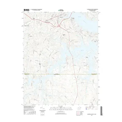
2016 Map of Clarksville South
USGS Topo · Published 2016About this map
John H. Kerr Reservoir dominates the landscape in this 2016 survey, where the waters of the Roanoke River meet the irregular shoreline of the Virginia-North Carolina border. The area around Clarksville serves as a transportation and aviation hub, featuring both the Lake Country Regional Airport and Merifield Airport. This modern record reveals a mix of established small communities like Buffalo Junction and Sandy Fork alongside rural crossroads such as Puryear Corner and Shiny Rock.
Find a feature on this map
115 named features on this map. Tap any name to fly to it.
Don’t see what you’re looking for? This feature index may not catch every label — zoom into the map to look around manually.
Map Details
Editions of this 2016 Clarksville South Map
This is the sole edition of this map. No revisions or reprints were ever made.
Other maps of this area

1941 · Clarksville
USGS Topo · 1:48,000

1943 · Clarksville
USGS Topo · 1:62,500

1953 · Oxford
USGS Topo · 1:62,500

1953 · Greensboro
USGS Topo · 1:250,000

1954 · Greensboro
USGS Topo · 1:250,000

1955 · Boydton
USGS Topo · 1:62,500

1957 · Clarksville
USGS Topo · 1:62,500

1962 · Greensboro
USGS Topo · 1:250,000

1966 · Greensboro
USGS Topo · 1:250,000

1966 · Oxford
USGS Topo · 1:62,500