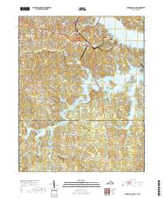
2019 Map of Clarksville South
USGS Topo · Published 2019About this map
John H. Kerr Reservoir dominates the landscape south of Clarksville, where the jagged shoreline of the impounded waters defines the border between Virginia and North Carolina. The map traces the fingers of the reservoir as they reach into the drainage basins of Beaver Pond Cr, Lick Br, and Spewmarrow Creek. This 2019 survey captures a transition from the structured street grid of the town to the rural outlying settlements of Buffalo Junction, Sandy Fork, and Puryear Corner.
Find a feature on this map
115 named features on this map. Tap any name to fly to it.
Don’t see what you’re looking for? This feature index may not catch every label — zoom into the map to look around manually.
Map Details
Editions of this 2019 Clarksville South Map
This is the sole edition of this map. No revisions or reprints were ever made.
Other maps of this area

1941 · Clarksville
USGS Topo · 1:48,000

1943 · Clarksville
USGS Topo · 1:62,500

1953 · Oxford
USGS Topo · 1:62,500

1953 · Greensboro
USGS Topo · 1:250,000

1954 · Greensboro
USGS Topo · 1:250,000

1955 · Boydton
USGS Topo · 1:62,500

1957 · Clarksville
USGS Topo · 1:62,500

1962 · Greensboro
USGS Topo · 1:250,000

1966 · Greensboro
USGS Topo · 1:250,000

1966 · Oxford
USGS Topo · 1:62,500