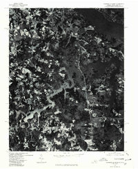
1977 Map of Clarksville South
USGS Topo · Published 1979About this map
Clarksville serves as a northern anchor on this orthophoto map, where the sprawling waters of the John H Kerr Reservoir dominate the landscape. Unlike traditional line maps, this 1977 aerial perspective from the U.S. Geological Survey reveals the literal footprint of the land, showing the dense forested tracts and cleared agricultural fields surrounding the reservoir's fingers. To the west, the crossroads of Buffalo Junction and Sandy Fork appear alongside a patchwork of rural homesteads and roads. The imagery provides a clear view of the water's edge along Grassy Creek and the notable terrain at Shiny Rock, documenting the Virginia-North Carolina border region during the late 1970s. This visual record is particularly useful for observing land use and property boundaries as they existed shortly after the reservoir had fully reshaped the local topography.
Find a feature on this map
6 named features on this map. Tap any name to fly to it.
Don’t see what you’re looking for? This feature index may not catch every label — zoom into the map to look around manually.
Map Details
Editions of this 1977 Clarksville South Map
This is the sole edition of this map. No revisions or reprints were ever made.
Other maps of this area

1941 · Clarksville
USGS Topo · 1:48,000

1943 · Clarksville
USGS Topo · 1:62,500

1953 · Oxford
USGS Topo · 1:62,500

1953 · Greensboro
USGS Topo · 1:250,000

1954 · Greensboro
USGS Topo · 1:250,000

1955 · Boydton
USGS Topo · 1:62,500

1957 · Clarksville
USGS Topo · 1:62,500

1962 · Greensboro
USGS Topo · 1:250,000

1966 · Greensboro
USGS Topo · 1:250,000

1966 · Oxford
USGS Topo · 1:62,500